Melton Weir Parkland
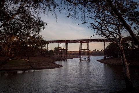
Melton Weir, also known as Melton Reservoir, is a large body of water located to the south and west of Melton Township. The Melton Weir Parklands span a distance of around 5 kilometres along the northern banks of the weir, from north of the Melton Viaduct in Brookfield, through to the weir (dam) wall in Weir Views.
Previously within rural surrounds, the Melton Weir has been transformed through the ongoing development of a residential interface along its north-eastern edge. Linear parkland and trails separate the weir from the residential development and provide the public with scenic views and recreational opportunities.
Council has recently completed the Melton Weir Parkland Strategy, which provides direction on the future development of the wider linear parklands, as well as a more detailed vision for the Arnolds Creek Confluence. The Parkland Strategy aims to improve access and opportunities for recreation along the weir and to transform the weir into a recreational drawcard for Melton and the wider region.
Council adopted Melton Weir Parkland Strategy 2024(PDF, 18MB) on the on the 24 June 2024. The Council meeting agenda items, associated appendices, and meeting minutes can be found on our Council meetings/minutes web page.
Melton Weir Development Committee
The Melton Weir Parkland Strategy was developed with significant input from the Melton Weir Development Committee. The Melton Weir Development Committee was formed in 2012 to guide the planning and development of parkland adjoining the Melton Weir. Southern Rural Water who manage the water body and the traditional owners of the land both have a role on the committee.
The Melton Weir Development Committee meets either virtually or in person six times a year to assist Council in:
- Developing a plan that considers opportunities, and improvement works to ensure our community can achieve a higher level of social, economic and environmental benefit from the Melton Weir.
- To ensure any plan respects, understands and considers the interests and requirements of the traditional owners of the land.
- To guide Council on its vision to have the Melton Weir identified as a tourism destination, recreational and scenic asset of regional significance.
- To connect and understand community aspirations and expectations for the use and enjoyment of the Melton Weir.
- To improve the walking path/cycle connections to and from parklands lining the Melton Weir and Werribee River to existing and future urban areas.
- To explore and consider funding opportunities to implement Council’s vision and plan for parkland, pathway and amenity improvements adjoining and connecting to the Melton Weir.
- To support the promotion and awareness of the community and stakeholders on the vision and plan improvements for the Melton Weir.
Community Consultation Summaries
Melton Weir Parkland Strategy
Melton Weir Parkland Strategy(PDF, 18MB)